


A Walk in the Woods
The longest, and most challenging hiking trail at Keji is the Liberty Lake Trail. This hike is truly a wilderness hiking experience. The terrain has low, rolling hills, drumlins and eskers, but there are no long or steep hills. The footing is generally good, but sections are rock or root strewn. There are two boggy areas and one river bed area where you can get wet and muddy during wet weather. The trail is best done over four days and three nights.
The trail roughly follows the park's boundary to the north, west and south. There are a number of trail heads from where you can start this wilderness hike. The first is the parking lot at Big Dam Lake, from where you will traverse the trail in a counterclockwise direction. You can also start your hike at the Grafton Lake Parking Lot, or the Lower Mersey River Parking Lot (at the Eel Weir). From any of these points, you will traverse the trail in a clockwise direction. The road from the Grafton Lake Parking Lot ends at the Lower Mersey River Parking Lot. From late fall to early spring, this road is gated at the Grafton Lake Parking Lot. At all other times, this road is gated at the Lower Mersey River Parking Lot. The trail is 64km long from the Big Dam Parking Lot to the Grafton Lake Parking Lot, and 56km long to the Lower Mersey River Parking Lot. Detailed hiking distances are provided on the Backcountry Hiking Distances page.
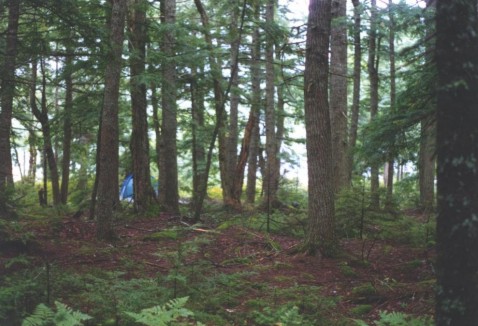
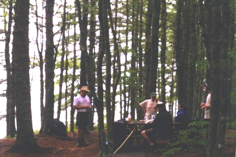
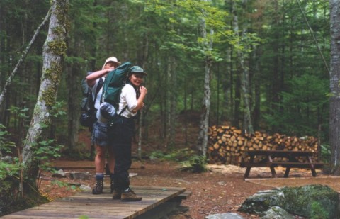
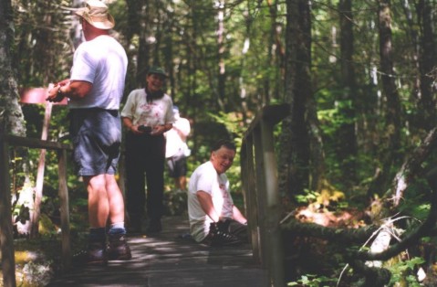
There are eleven wilderness campsites along the trail. Each site features a metal fire box, a picnic table, an outhouse, one or more tent pads and firewood. You must register at the Visitor Centre before doing this hike, and during the registration process, you will reserve the campsites you will use.
This preview of the Liberty Lake Trail starts at the Big Dam Parking Lot, and takes you through to Campsite #37 on Pebbleloggitch Lake. From there, you hike on a road to Lower Mersey Parking Lot (19km) or Grafton Lake Parking Lot (27km).
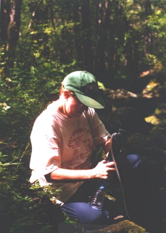
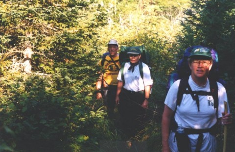
The photos are by Nancy Spencer. You can click on any of them to view an enlargement.
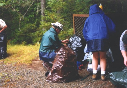
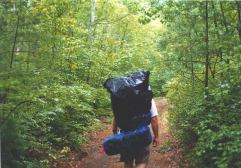
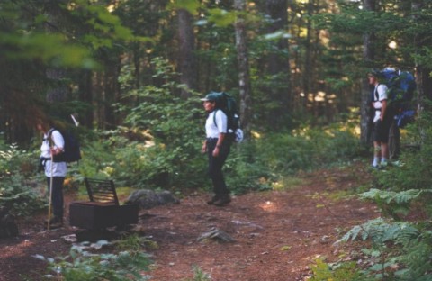
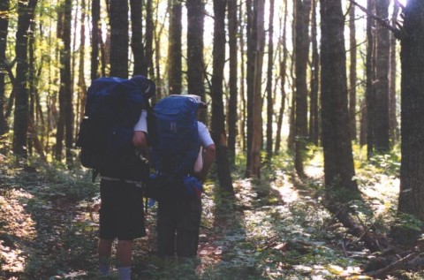
On a rainy August day in 1999, we prepare to start the Liberty Lake Trail at the Big Dam Parking Lot. Because of the rain, our packs are covered with plastic bags. Our plan is to spend four days and three nights on the trail. Since our first hike on this trail twenty years ago, little has changed. The scenery is just as beautiful, the wilderness is just as remote and the trail is just as long.
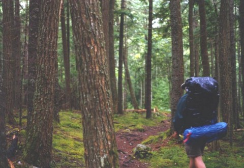
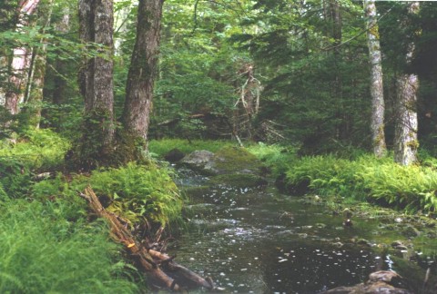
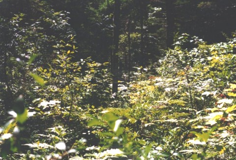
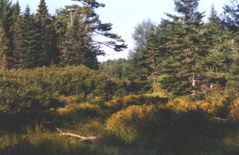
After leaving Big Dam parking Lot, the trail passes through an open softwood forest along the length of Big Dam Lake. For the first while, you are on a gravel trail that is part of the Hemlocks & Hardwoods Trail. There you have boardwalks and bridges over the wet spots, but that will change.
About half way up Big Dam Lake, you will pass Campsite #3, on the shore of Big Dam Lake. If the site is not occupied, this is an excellent resting place.
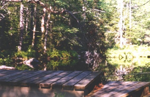
After Campsite #3, the trail is still in an open softwood forest and the hiking is good. Along the entire trail, the way is marked with trail markers on the trees. These markers are bright orange plastic strips, or yellow metal triangles. Although the trail is easy to follow at this point, later on you will need to keep a sharp eye out for the trail markers so that you do not get off the trail. At the upper end of Big Dam Lake, the trail will emerge from the forest on to an old road. Turn right and hike down the road. Soon, you will come to a fork in the road. Bear left and go down the hill to the bridge at Thomas Meadow Brook.
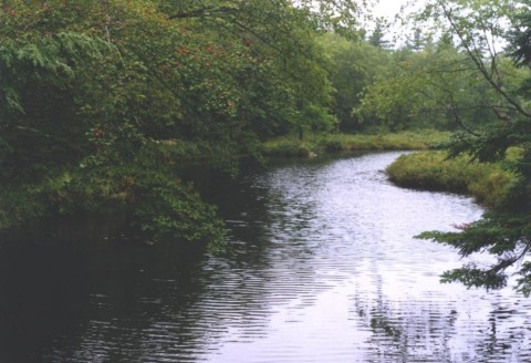
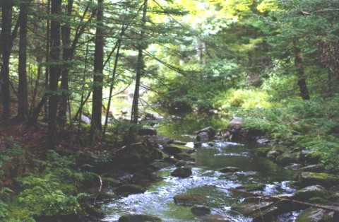
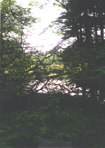
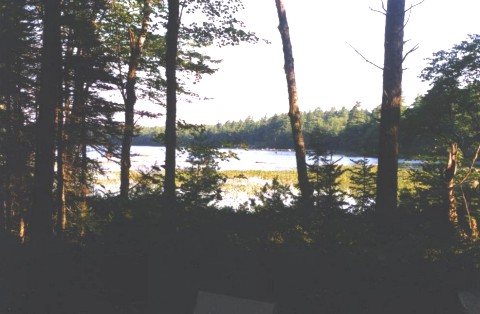
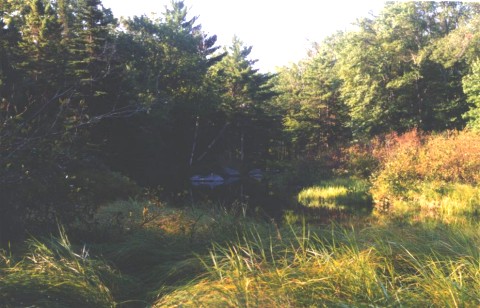
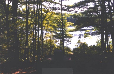
From the bridge, you have a beautiful view of Thomas Meadow Book. This is the first of many scenic views that you will experience on the hike.
The old road you are on travels across country from Big Dam Lake to Frozen Ocean Lake. For the first while, the road is in good condition and the going is good. Later on, the road is washed out and rocky and the going gets slower. The road ends at the head of Frozen Ocean Lake, where you will see a trail junction sign. To the left is the Channel Lake trail, and just a few meters up that trail is Campsite #46. The Liberty Lake Trail goes the other way, to the right.
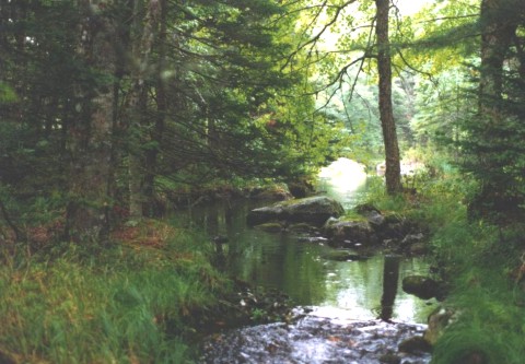
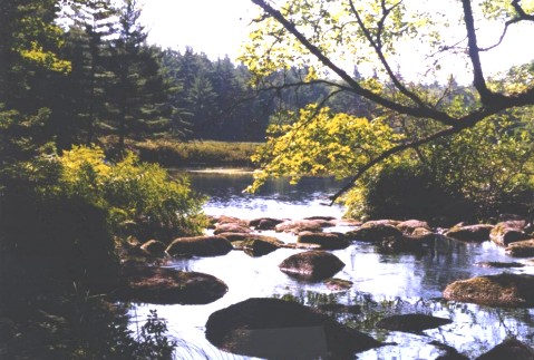
A few hundred meters from the trail junction, going right, is a bridge over picturesque Torment Brook. This cold brook empties into Frozen Ocean Lake just downstream from the bridge. You will find a nice swimming hole there, if you can stand the cold water.
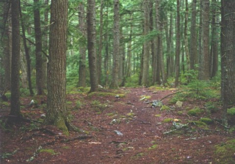
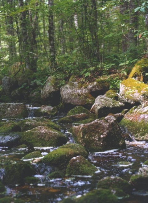
A short distance from Torment Brook is Campsite #45, another good resting spot. The campsite is part way up the hill from the trail, with a good view of Frozen Ocean Lake. The trail follows the shores of Frozen Ocean Lake for most of its length. This section of the trail is very rocky and can be slippery in wet weather. After passing Campsite #7, the trail turns right onto an esker that was part of an old Mi'qmaq portage from the Bear River country through to Frozen Ocean Lake.
The trail leaves the esker, turning to the left and goes down the steep side of the esker to Stewart Brook and Campsite #44.
Campsite #44 is a good stopping point for the first day. At this point, you will have traveled over 11km. The fast flowing brook is a lovely sound to listen to while falling asleep in the tent. At Campsite #44, you have entered the true wilderness portion of Kejimkujik National Park.
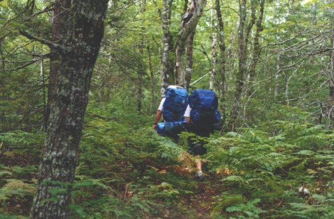
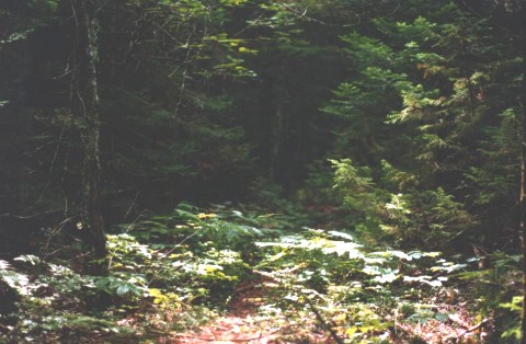
Beyond campsite #44, the trail is more obscure and overgrown. A few minutes above the campsite, you will pass through the edge of an old growth hemlock forest, and then will hike through mixed forest for approximately an hour to Campsite #43 on Innes Brook.
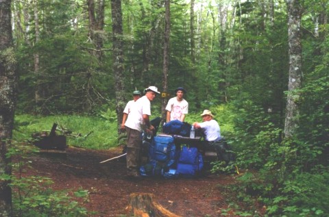
Campsite #43 is another lovely campsite on the edge of a fast flowing brook. It is another favorite stopping point for the first night, if you have enough stamina to get that far (15km).
Innes Brook flows by the campsite, under the bridge and on downstream to distant Frozen Ocean lake.
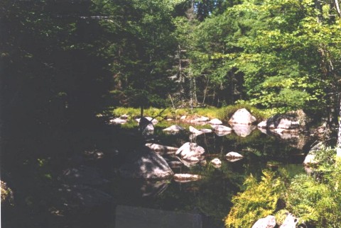
From the campsite, you can see, through the trees, a stillwater on the brook. After leaving Campsite #43, the trail continues through mixed forest for approximately one and one-half hours to the Northwest Branch of the West River.
The bridge over the Northwest Branch is another excellent resting spot. We always try to make it our lunch stop. The water rushing under the bridge stirs up a nice cool breeze and the heavy canopy overhead give a lovely shade from the sun.
Drinking water on the hike comes primarily from the fast flowing brooks, and maybe from the lakes. It is always a good idea to boil or filter the water before drinking it, to avoid any chance of illness.
Above the Nothwest Branch, the trail goes on toward Liberty Lake. On this section, you will encounter the first boggy area where you can get wet and muddy, unless the weather has been very dry. You will see Little Liberty Lake through the trees to your left and then you will see Liberty Lake ahead. At Liberty Lake, the trail turns to the left and follows the shores of the Lake. Part way down the lake you will pass a Warden Patrol Cabin (closed to the public) and a few minutes later, you will arrive at a trail sign.
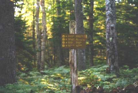
At the trail sign, the Liberty Lake Trail carries on straight ahead, and Campsite #42 is on a short side trail to your right.
Campsite #42 is the most remote wilderness campsite in Kejimkujik National Park.
It sits on the end of Liberty Lake, where you have a nice view down the lake. This campsite is a good stopping place for your second night. You have now traveled 22.5km.
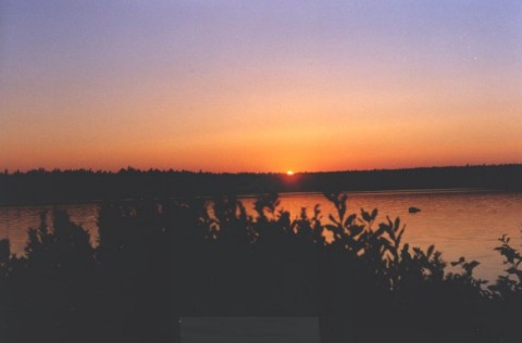
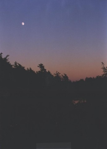
As night falls, you will be able to watch a beautiful sunset and watch the moon rise over the lake (weather permitting).
After leaving Liberty Lake, the trail runs overland to the West River. On this section of the trail, you hike through a meadow on the edge of the West River. Here you may get wet again, as the meadow is often flooded. Along this section of the trail, you will be treated to several beautiful views of the lazy river on your right.
Toward the end of this section, you climb up on to an esker and hike through another hemlock stand. To you left, you will see a large bog called Caribou Bog. Keep your eyes open for a trail sign that marks the junction with the West River Trail. At the junction, if you go straight ahead, you will be on the West River Trail, which goes down to Campsite #22 (about 3 hours away). The Liberty Lake Trail goes sharp right at the junction and down to side of the esker to the West River. This is the way you want to go.
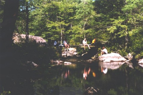
At the West River, there are two bridges that cross the river and cross Red Brook. This is another excellent resting place.
The scenery here is magnificent. As you rest on the first bridge, you are treated with a view of the stillwaters where Red Brook flows into the West River. After leaving the bridges, the trail loosely follows Red Brook all the way through to Big Red Lake. Around the end of Big Red Lake, you will encounter the second boggy area. Again, you are likely to get wet and muddy in this section. After Big Red Lake, you will again see a trail marker sign, where there is a side trail to the right. This trail takes you to Campsite #41, about 1km distant. The main trail carries on, mostly downhill, over another section of rocky trail to Lucifee Brook.
The bridge at Lucifee Brook marks the end of the wilderness portion of the Liberty Lake trail. From here to your destination trailhead, you will be hiking on a good road. This bridge is another great resting stop, with another scenic brook view. It is also a good place for a swim. From here, you hike down the road for approximately an hour and a half to Campsite #37. Sections of the road are very sandy, and can be hard on the feet.
Campsite #37 is also known as Mason's Cabin, the only cabin campsite in the park. It sits on the side of the road, close to Pebbleloggitch Lake. Mason's Cabin is a popular campsite for the third and final night on the trail. At this point, you have traveled 37.5km.
From Campsite #37, on your fourth day, you continue to follow the road to the Peskowesk Lake Parking Lot (11km), the Lower Mersey River Parking Lot (19km) or the Grafton Lake Parking Lot (27km). You will have now completed the Liberty Lake Trail. Don't forget to turn in your backcountry permit at the Visitor Centre.